


Real-Time Yard Positioning, Monitoring & Shunting Safety
The Challenge
Yard and shunting crews coordinate a lot at once: tracking where every consist sits, managing work gangs, running coupling and uncoupling moves, often across an entire yard using little more than radio calls and a paper board or spreadsheet. It’s demanding, skilled work, and experienced crews do it well. But the tools supporting that work haven’t kept pace with how busy modern yards have become. Automated alternatives on the market today tend to solve part of the problem but few deliver a single, continuously updated picture of the whole yard built from rail-native positioning infrastructure.
Piper’s Approach
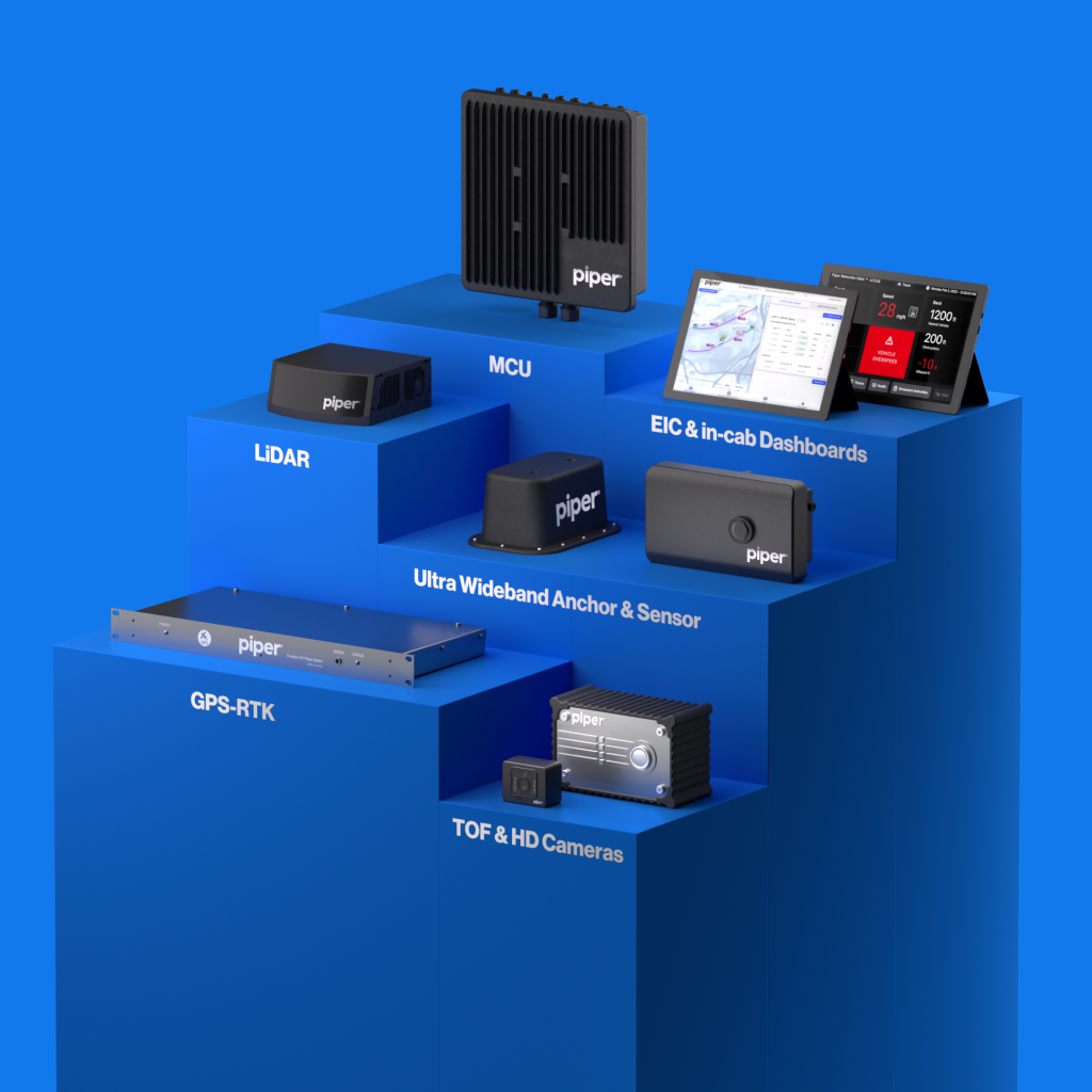
Piper YardCompass runs on the same multi-sensor positioning platform already proven in revenue service: SIL-4 certified Ultra Wideband (UWB), GPS-RTK, and TrackSight™ LiDAR. Piper’s UWB and TrackSight™ LiDAR deliver primary positioning in GPS-degraded yard environments, where precise track identity and low-speed protection are critical.
Positioning data feeds directly into a live dashboard showing every vehicle’s location, movement, and status across the yard, using the same Fleet Manager dashboard architecture already running in revenue service today. The same positioning platform also supports safe coupling and shunting moves, giving operators live proximity data and vehicle identification as two cars come together.
How it Works
Three layers working together: carborne sensors, wayside infrastructure, and the yard dashboard
LAYER 1 — Carborne (Onboard sensors & identification)
Each vehicle carries Piper’s multi-sensor package — UWB, TrackSight™ LiDAR, and an integrated HD camera. GPS-RTK receivers provide centimeter-level position where available and hand off seamlessly to UWB and LiDAR indoors or underground.
LAYER 2 — Wayside (Fixed reference infrastructure)
UWB anchors are installed on yard structures, walls, and poles — no trackbed equipment or excavation required. GPS-RTK base stations install inside existing infrastructure huts, requiring no new structures on site.
LAYER 3 — Dashboard (Fusion, visualization & alerting)
Sensor data fuses into one validated position per vehicle, shown live with switches and other TPOI overlaid. Operators get proximity alerts via the TOD; dispatch and maintenance see the same picture from the back office.
Key Capabilities
- Real-Time Yard Dashboard. Every vehicle’s position shown live and continuously updated on a single map, with switches and other TPOI overlaid.
- Quick integration with SCADA, martialing, and scheduling back office system yielding improved control out of the box.
- Multi-Sensor Redundancy. UWB, GPS-RTK, and TrackSight™ LiDAR fused into a single validated position. No single point of failure, full coverage indoors and out.
- Coupling & Shunting Safety. Live proximity data and automated vehicle identification delivered to the TOD as cars approach for coupling, with a verification step before coupling completes.
- HD Forensic Video. An integrated camera captures synchronized footage alongside positioning data, stored securely for post-event review.
- System Health & Diagnostics. Onboard vehicle data retrieved and surfaced on the same dashboard, with notifications on exceptions.
- Open Integration. Connects into the dispatch, OCC, and maintenance interfaces operators already use.
- Scalable, Incremental Deployment. Deploys on a single track or vehicle and scales to the full yard, with no rip-and-replace and no need to wait for a full network cutover.
- Remote Management & OTA Updates. Cloud-based administration monitors component health across the yard, with over-the-air updates for ongoing maintenance.
Why Piper
| | Manual / Spreadsheet Tracking | Asset-Location Completion Systems | Single-Vehicle Vision Safety Systems | Piper YardCompass |
| Real-time, automated | No | Yes | Yes, single vehicle | Yes, whole yard |
| Built for rail from the ground up | No | Extended from other transit modes | Yes | Yes |
| SIL-4 certifiable positioning core | No | No | No | Yes |
| Redundant, GPS-independent | No | Varies | Varies | Yes |
| Switch / TPOI awareness on live map | No | Limited | Varies | Yes |
| Operator alerting in-cab | No | No | Varies | Yes, Train Operator Display |
| Coupling / shunting proximity assist | No | No | Yes, vision-based | Yes, positioning-based, yard-wide |
| Forensic video capture | No | No | Varies | Yes |
| Trackbed equipment required | N/A | Sometimes | No | No |
Standards: CENELEC EN 50126 · EN 50128 · EN 50129 · AREMA C&S 11.5.1 · IEEE 1478 · SIL-4 — TÜV SÜD
Deployed Today
Piper’s SIL-4 certified UWB, GPS-RTK, and TrackSight™ LiDAR platform is currently being deployed at MBTA on the Green Line, delivering Automatic Train Protection. The deployment includes the same proximity awareness and coupling functionality that underpins YardCompass, using live TOD proximity data as vehicles approach each other.
Also Part of the Piper Yard Portfolio
For maintenance facilities that need enforced worker protection alongside vehicle positioning, Piper’s Blue Signal Protection platform digitizes the blue flag and padlock workflow — verifying Worker-in-Charge authority, maintaining a live protected-track roster, and enforcing release conditions until every worker is accounted for. Ask us about pairing it with YardCompass.